Awa blends deep expertise in modelling, planning, and engineering with practical digital capabilities to improve how organisations unlock new value from complex data and models.
Managing models as long-term assets requires more than storage.
The quality of a model is dependent on the quality and consistency of its inputs.
Working with large and complex network datasets can be time-consuming and error prone.
Flood maps are one of the most visible and impactful outputs of modelling.
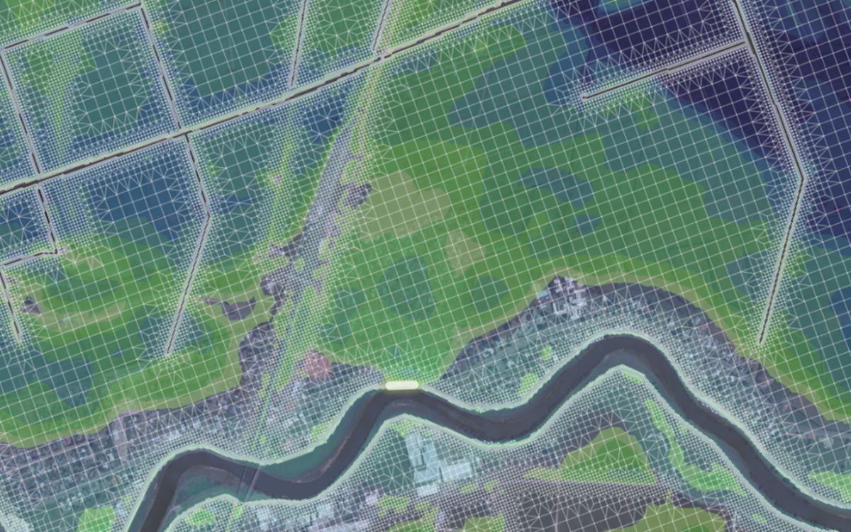
Representing rivers and channels accurately within models is critical.
Hydrology underpins catchment modelling, yet approaches can vary between projects.
Across the industry, significant effort goes into building models, yet far less attention is given to how they are managed, maintained, and used over time.
Models are often treated as project outputs rather than long-term assets. Data becomes fragmented. Workflows are inconsistent. Knowledge is lost between projects. Confidence in the models reduces over time.
Awa’s approach is different. We treat models as part of an ongoing lifecycle: from planning and data preparation through to model build, use, sharing, and maintenance.
Our digital capabilities are focused on strengthening this lifecycle – improving consistency, reducing rework, and enabling better decisions and outcomes.
We do this primarily by strengthening the workflows around specialist modelling software, such as TUFLOW, InfoWorks ICM, and DHI MIKE, to enhance how:
Our innovations have grown from decades of experience delivering projects of all shapes and sizes. They are designed to solve real challenges faced by councils, infrastructure providers, developers, designers, and others.
Many take the form of tools, scripts, and workflows, developed to solve specific challenges and applied in different ways, depending on client needs.
Often, they are embedded within Awa’s integrated services to enhance the quality, efficiency, and consistency of modelling.
Where appropriate, we can configure environments or workflows that support clients directly. For example, in managing model data, improving governance, or enabling repeatable processes.
We also work collaboratively with clients to develop new capabilities where there is a clear need and alignment with broader challenges across the sector.
Our approach is flexible and technology-agnostic.
We work with different modelling platforms, GIS systems, and client environments, and focus our capabilities on integration rather than replacement. This allows our clients to retain flexibility, avoid vendor lock-in, and build capability that evolves over time.
While our work has grown from stormwater, flood risk, and catchment modelling, the underlying challenges are common to many sectors. Where organisations rely on complex models, large datasets, and defensible decision-making — in areas such as transport, infrastructure, and environmental management – there is an opportunity to apply similar
approaches.
If you’re thinking about how your organisation manages, maintains, and applies modelling information — or how to get more value from your data and models over time — then get in touch.